


Information...
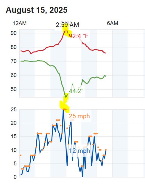
8-15-2025...05:50: We had a heat burst last night, the temperature rose to 92.4° around 3 AM, with a 26 mph wind and dew point crash down to 44°. Must of had some decaying thunderstorm activity in the area. This was the 2nd or 3rd occurrence this summer. So our high temperature for today has already reached 92° before sunrise. Looking at data on the Miller Field ASOS, it did report a trace of rain at 03:20 AM. No sign of even a trace here, if it did it evaporated. The WSW image on the front page updates about every minute now without a full page refresh. For the full size image, use the 'Cameras' link. Now the streaming camera can run uninterrupted for up to 5-minutes before a page refresh.