
 Forecast
Historic Midwest Blizzard of 1949, Valentine Nebraska.
Month of January 1949
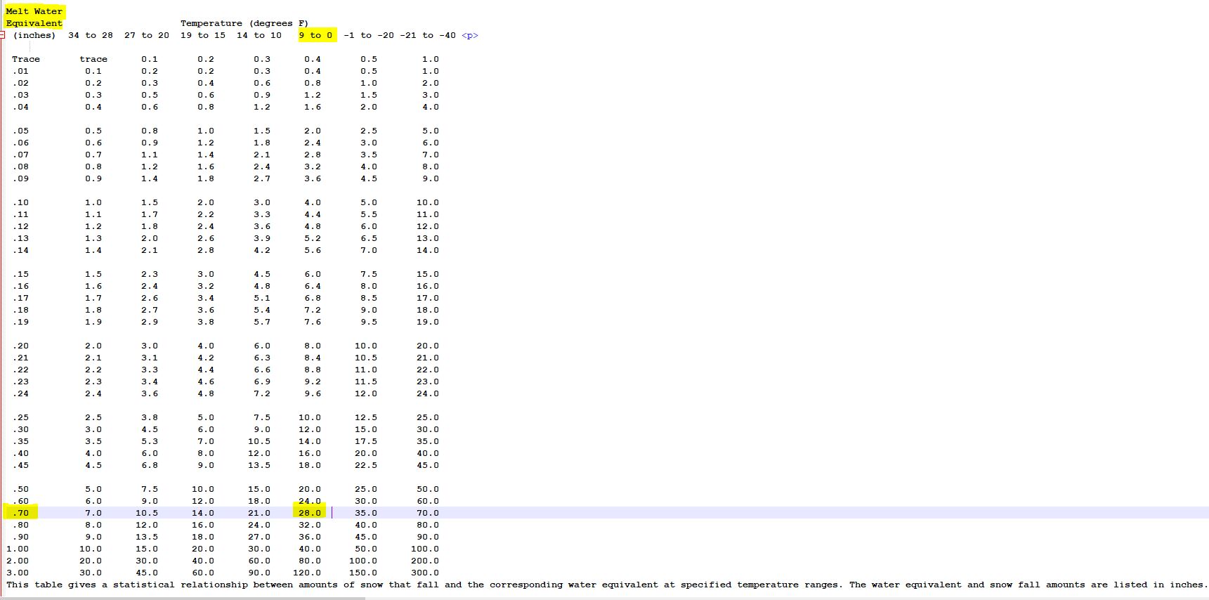
The Valentine Weather Bureau in 1949 was located downtown, instruments were located on top of the Weather Bureau building. Reviewing records for the time period show the 10:1 snowmelt standard was being overused and is not accurate for very cold temperatures. The Weather Bureau reported 2-day storm total (.65") moisture snowmelt and (6.7") of snowfall for the blizzard. While interviewing residents of Valentine who lived here during the blizzard of 1949, including relatives some chuckled at the idea of a 6-7" snowfall, and all thought very inaccurate. My mother who turned 13 in 1949 reported you could walk rooftop to rooftop on drifts between homes in town. Temperatures were very cold in the (7 to -2) f range during the entire Jan 3rd blizzard and should of produced approximately 25-28" of snowfall with the measured moisture content and would have been more inline with witness reports. You can't get rooftop snowdrifts with seven inches of snow. Below is another Valentine area weather stations historical record that gives a more accurate account of the Blizzard.
Valentine Lakes 14 miles south of town. Unfortunately no snowmelt was done but from experience Valentine likely had similar numbers.
GHCND:USC00258755 VALENTINE NE US
This was the daily report for main blizzard, Date: 01/03/1949
SNOW (Snowfall): 27.0 inches,
SNWD (Snow Depth): 35.0 inches,
TMAX (Hi Temp): 7.0F,
TMIN (Lo Temp): -6.0F
Below is the full month, records are incomplete for this station, snow depth on the ground peaked at 38" on the 5th. The most snow fell on the 3rd with 27". Snow drifts were reported as high as 15 feet in areas, while the temperature plummeted to -29 on the 21st. Also included the NOAA snowmelt table showing relationship between air temperature and moisture measured.
Click to expand image
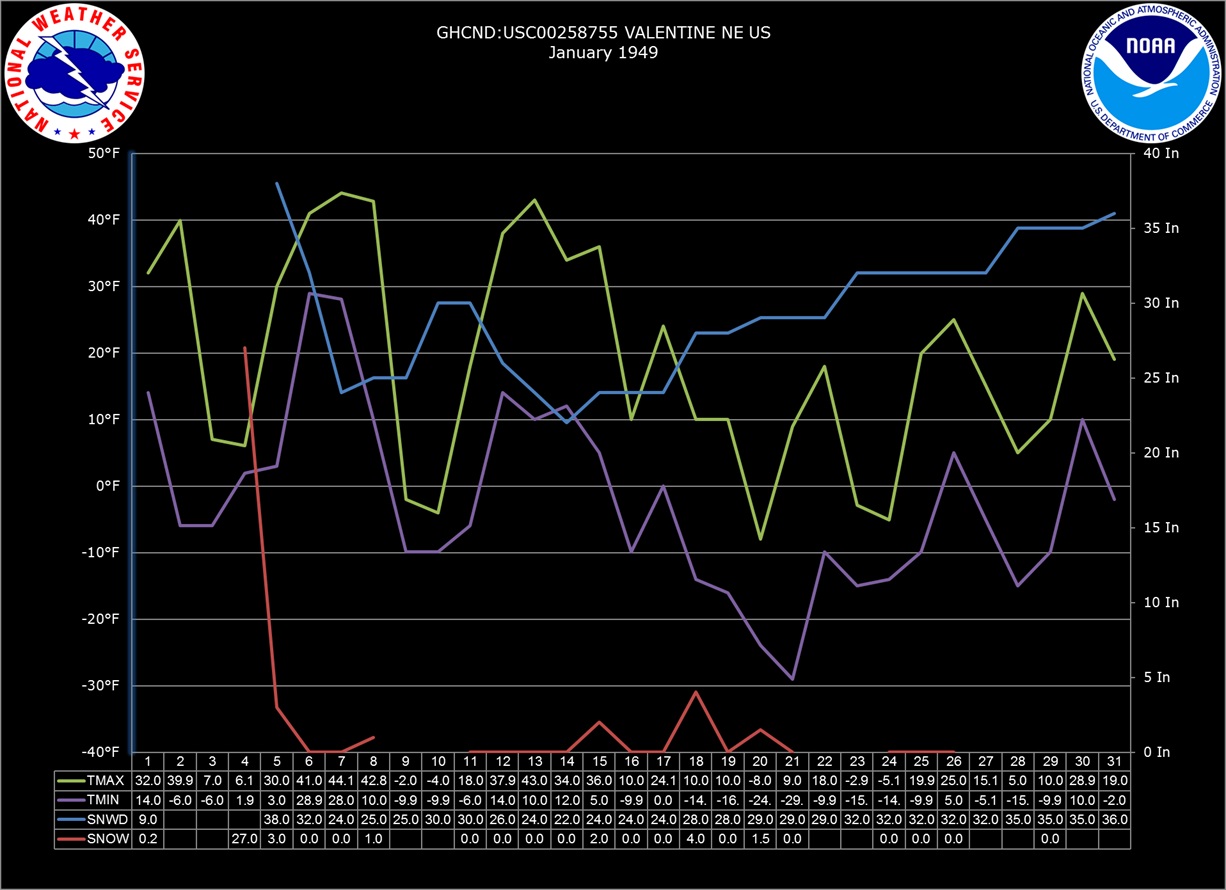
I would like to give special thanks to Jim, NWS contractor for helping find this information. I'm not sure how common it is with other weather stations but the average snowfall for Valentine has been under measured for years using the (10:1) snowmelt scale most of the time. In my personal experience during the 7-8 years of measuring snowfall here, I've seen as high as 27:1 with around 13:1 being the average. Looking at the month of January (1949) at Valentine Lakes site, 17 days went below zero with 3 days where high temps stayed below zero.


© 2026, Valentinenebraska.net |
Cumulus (1.9.4-b1099) |
You are welcome to share and disseminate weather information from this website for non-profit purposes. For businesses, please attribute information to valentinenebraska.net... Never base important decisions that could result in harm to people or property on this weather information or website.

You are welcome to share and disseminate weather information from this website for non-profit purposes. For businesses, please attribute information to valentinenebraska.net... Never base important decisions that could result in harm to people or property on this weather information or website.